Korea on alert over Typhoon Haishen, heavy rain forecast; landslide warning issued
The 10th typhoon of the season is expected to reach waters between the southern island of Jeju and the Kyushu region of Japan on Monday morning, according to the Korea Meteorological Administration (KMA), Yonhap reports.
It's then likely to head north over the East Sea, although it was initially expected to land on the peninsula.
Haishen was barreling toward Korea at a speed of 22 kilometers per hour from around 290 km northeast of Okinawa as of 9 a.m. Sunday, KMA said.
Heavy rains and strong winds are forecast across South Korea throughout Monday, it added.
The state weather agency said the typhoon is likely to arrive in waters some 80 km east of Busan at around 9 a.m. Monday.
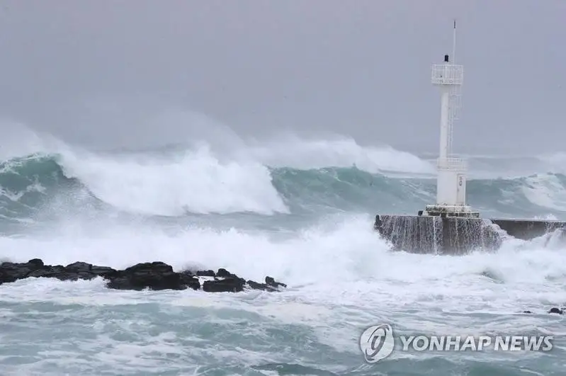
KMA officials called for thorough measures against possible rain and gale damages. They also warned of high waves in southern and eastern seas as well as waters near Jeju.
The Korea Forest Service (KFS) raised the landslide alert to «seriousness,» the highest in the four-tier system, for Jeju, Busan, Ulsan and the provinces of South and North Gyeongsang, Gangwon and South Jeolla.
It lifted the alert to «watch» for Seoul and 10 other major cities and provinces.
Haishen would be the second typhoon to hit the nation in a week.
«Huge damages are expected, as the typhoon this time is forecast to be more dangerous than the previous ones that affected South Korea shortly after the end of the monsoon season,» KFS chief Park Chong-ho said. «It's important to prevent damages through the preemptive evacuation of residents to an extent that could be (seen as) excessive.»